This week we explore Pine of course but we also venture further south. The story of Route 19 is as long as the road itself but most of it lost, simply because the stories were not preserved.
As I become more familiar with Pine (remember, I am not native) I hear people use local geographic terms that would make any young person say, “Hum?” The only one that has really stuck with me because I have actually used it in conversation is Wexford Flats (or sometimes just The Flats).
I bring that up for the simple fact that local names change, often more quickly than people realize. Having been involved with the Pine Township Historical Committee I was thrilled to hear the people talk about all the old farmhouses and businesses but I never heard any of them talk about the macadam and toll roads.
Granted, at least the toll roads were gone before their time but the I had never heard of macadam before and had to look it up.
A macadam road is a crushed stone road – think country, dirt roads.
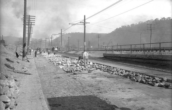
The above picture was on Wikipedia and is in Aspinwall, PA in 1908.
Laying Telford on Freeport Road, Aspinwall, Pennsylvania, 1908
In the 1800’s, Perrysville Pike, a 15(ish) mile stretch of road from Allegheny City (North Shore of Pittsburgh) to Wexford was planked with wood. This stretch of road was planked with wood because the mud from all of the travel was axel deep and made travel impossible in sections. You can only lay down so much hay before you’ve had enough and want a more permanent solution.
But maintaining the road was expensive and was privately funded. Planks were replaced at least once a year as they rotted which meant that the owners had to find a way to pay for those improvements.
The Commonwealth of Pennsylvania granted charters for the toll gates. Running exactly like the Turnpike today, you paid at each toll gate for the length of road you were to travel.
If you traveled the entire length you paid the full fare. If you promised the gatekeeper that you were not going to travel the entire way to the next gate he would calculate how much, you owed. Pennsylvania mandated three cents a mile but that wasn’t strictly followed.
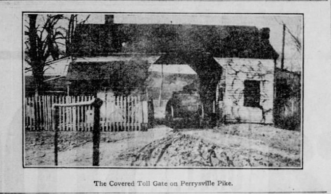
The first toll gate was just outside Allegheny City, city limits at West View with a hotel on either side of the road. The second toll gate was known as the covered gate but the location is unknown to me. For anyone familiar with North Hills history you may be able to determine the location. Apparently, the covered gate was also a grocery and had Peter Ivory’s Grocery written on the side. It was also a post office. The third toll gate had been abolished in the 1903 article that I referenced and the location wasn’t given. The final toll gate was in Wexford although I have not been able to determine its exact location.
A driver with one horse paid two cents at gate 1; five cents at gate 2; gate three was abolished so it was free but had at one point paid six cents; and seven cents at gate 4. If the driver had two horses, they paid double.
I’m not sure when Perrysville Pike was macadamized but the first reference I found was in 1910 (November 13; Pittsburgh Press, pg. 36). It was a real estate ad.
The toll gates are part of the local history that people didn’t record probably because they are mundane. They seem normal and uninteresting but now, over a hundred years later, it is really cool. Route 19 means so much to Pine and yet we probably can’t think of a reason to write about it. But this road, Perrysville Pike was the Route 19 of its time. It was the most important road for the communities it served but it was being replaced by crushed dirt roads to make way for automobiles and streetcars.
The article that I referenced, almost entirely was from the Pittsburgh Press, published March 29, 1903, page 26.
The featured picture also came from that article.